
March 6 Operations Plan
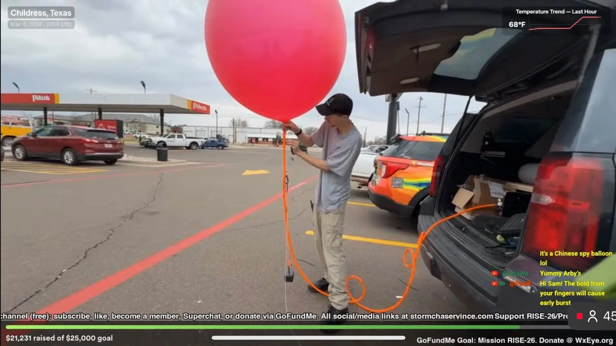
YESTERDAY March 5: Successful test. Our field team was able to capture an atmospheric sounding from Childress, Texas, ahead of a few severe storms without issue. Everything worked as intended. Link: https://sonde.projectweathereye.org/viewer/IMET-8E3C6A8F
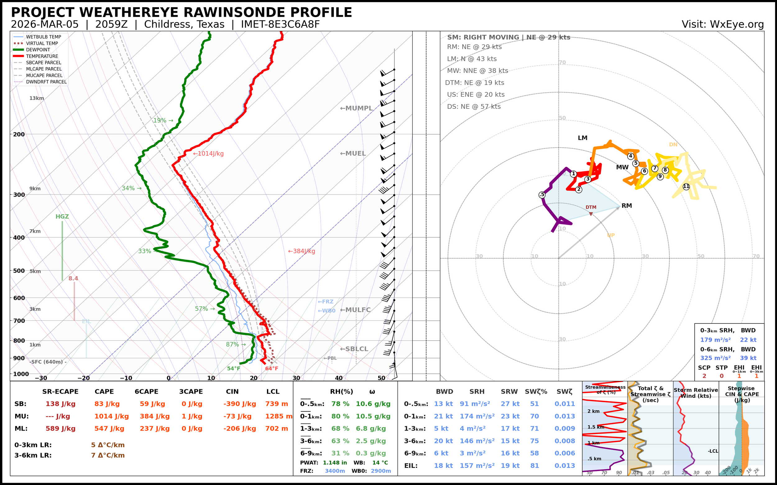
Analysis in SounderPy of the Childress Sounding
The sounding shows data that points to storms having a tendency to move north east around 30mph, which was what happened. The hodograph (on the right) shows the winds turning with height, which is what we’d expect for rotating storms to form.
The thermodynamic profile on the left, where red is temperature and green is dew point, shows some instability, but a bit of a cap around 800mb. You can see where the temperature line bends to the right sharply. That prevented storms from forming easily right away, but was eventually nullified as the surface temperature heated up.
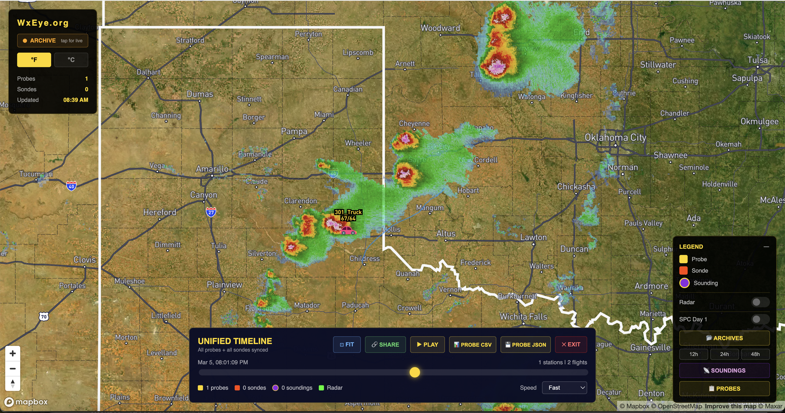
Our data archive viewer showing radar yesterday evening. Multiple clusters of storms.
SUPERCELL TARGET
We made a split second decision to launch a small balloon and sonde into the inflow path of a supercell riding right along the Texas/ Oklahoma border. The balloon was compromised around 14,000 feet, perhaps the very large hail (warned for tennis ball) is to blame. The inflow did suck the balloon into the updraft. What’s useful here is the hodograph.
The humidity sensor had a failure, but launched anyway. That’s why the dew point line is not what you’d expect on this sounding. https://sonde.projectweathereye.org/viewer/IMET-557D5E6D
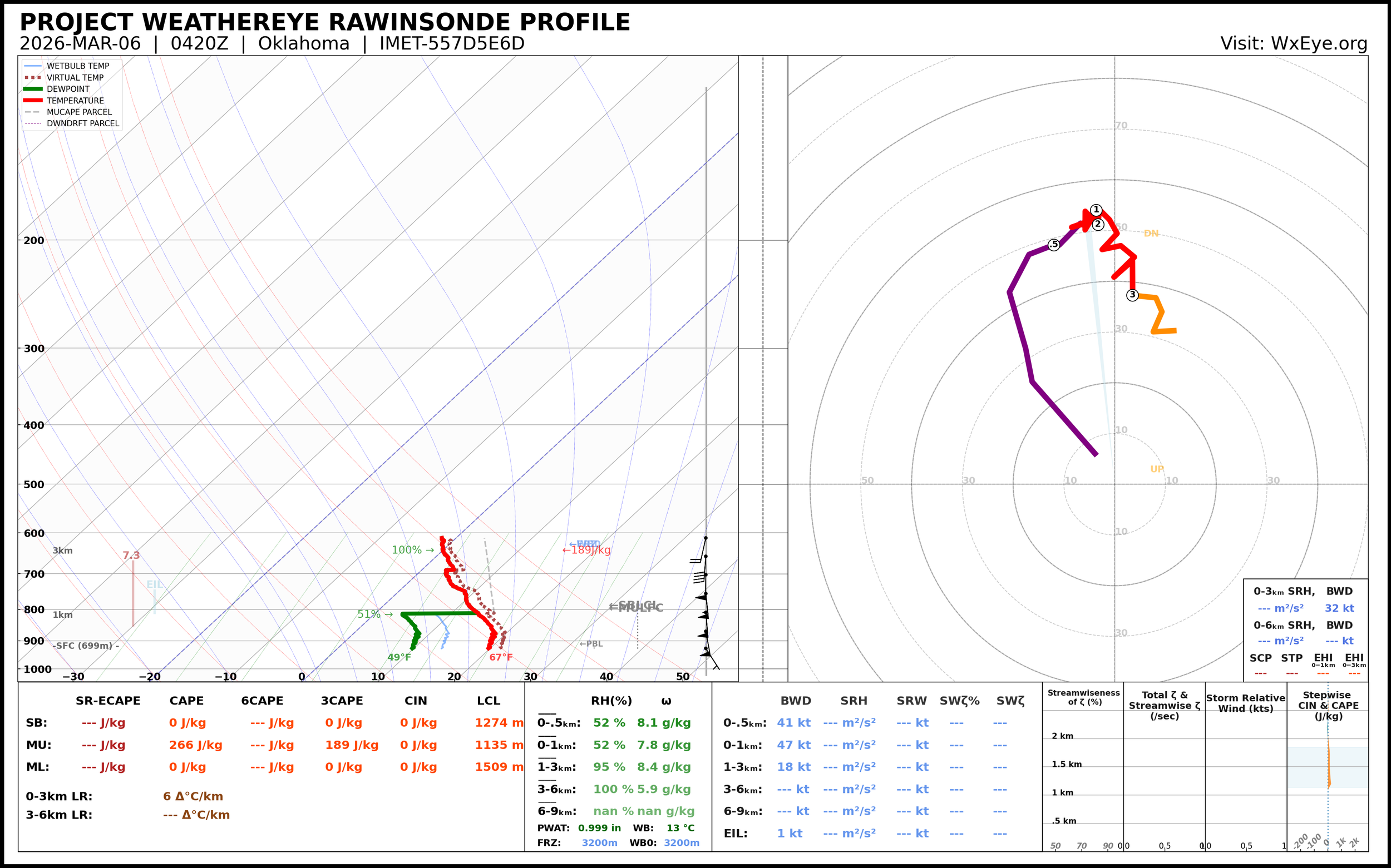
Sounding from the supercell
Our reason for doing this was to capture a near baseline expectation of how the balloons, sondes, and our system will behave in close supercell proximity. Now we know, and it’s chaos, which is fine.
Friday Level 3 Risk
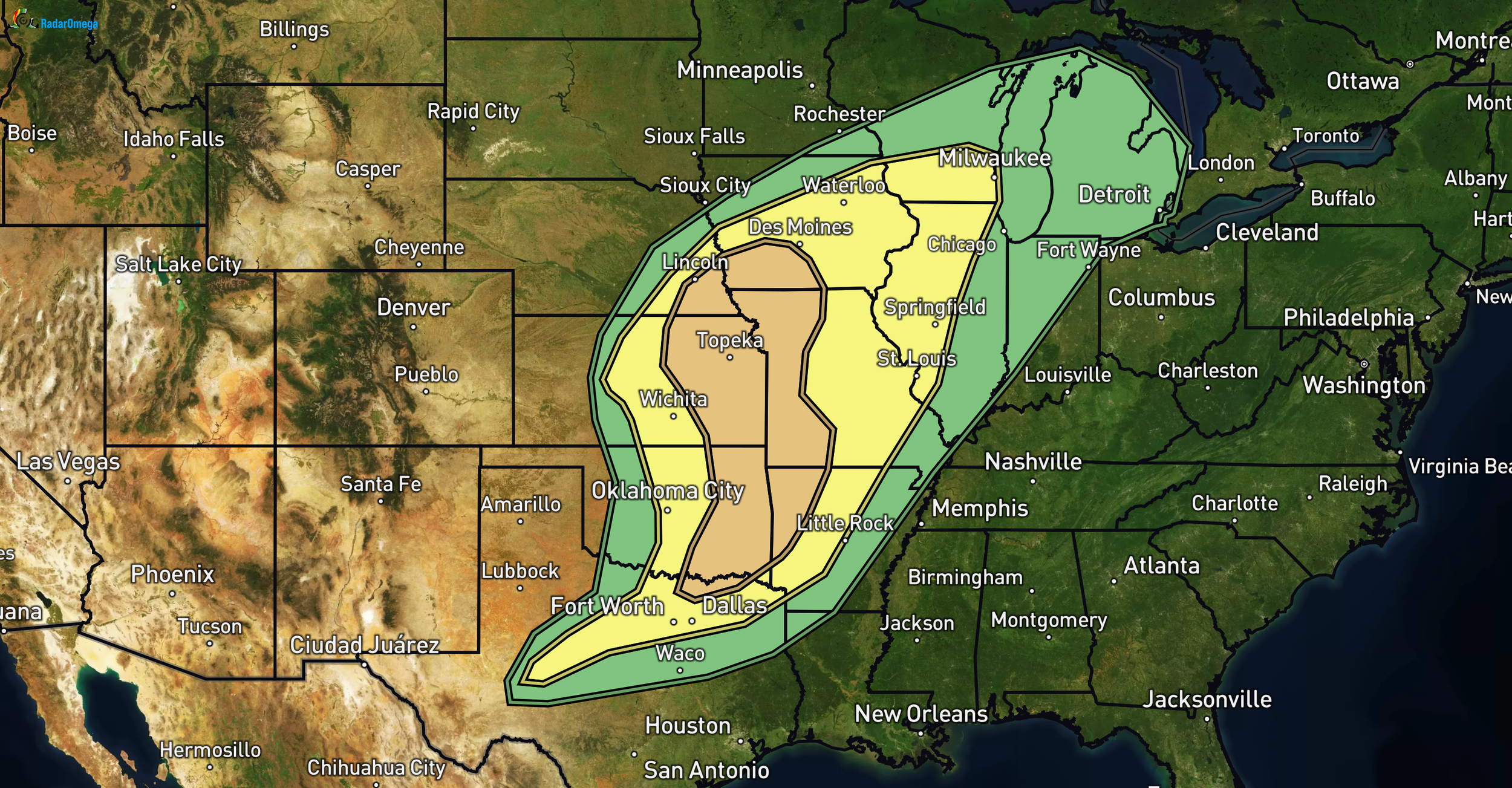
SPC Enhanced Risk (Level 3/5) eastern OK/KS/NE into western AR/MO/southern IA. Scattered severe storms mid-afternoon through tonight southern/central Plains to Ozarks/Midwest. Greatest threat: few strong tornadoes, very large hail (2+ inch potential) in eastern OK/KS/NE to western MO/AR/southern IA. MLCAPE 1000-1500 J/kg+ with heating, 50-70+ kt mid-level jet for strong shear/supercells early. Low-level jet strengthens evening, curved hodographs favor tornadoes (strong possible). Upscale to bowing clusters with wind damage likely along cold front into IA/MO.
Southern Plains/Ozarks: Dryline initiation uncertain afternoon/evening in OK/TX due to weak convergence. If cells form, very large hail and evening tornado risk with 35-45 kt shear and steep lapse rates (per OUN sounding). Better chance overnight with cold front advance—large hail, damaging winds.
Target today: TBD! There’s some more than expected clearing on visible satellite that could bring the Kansas/Oklahoma target back into play.
