March 5 Operation Plan
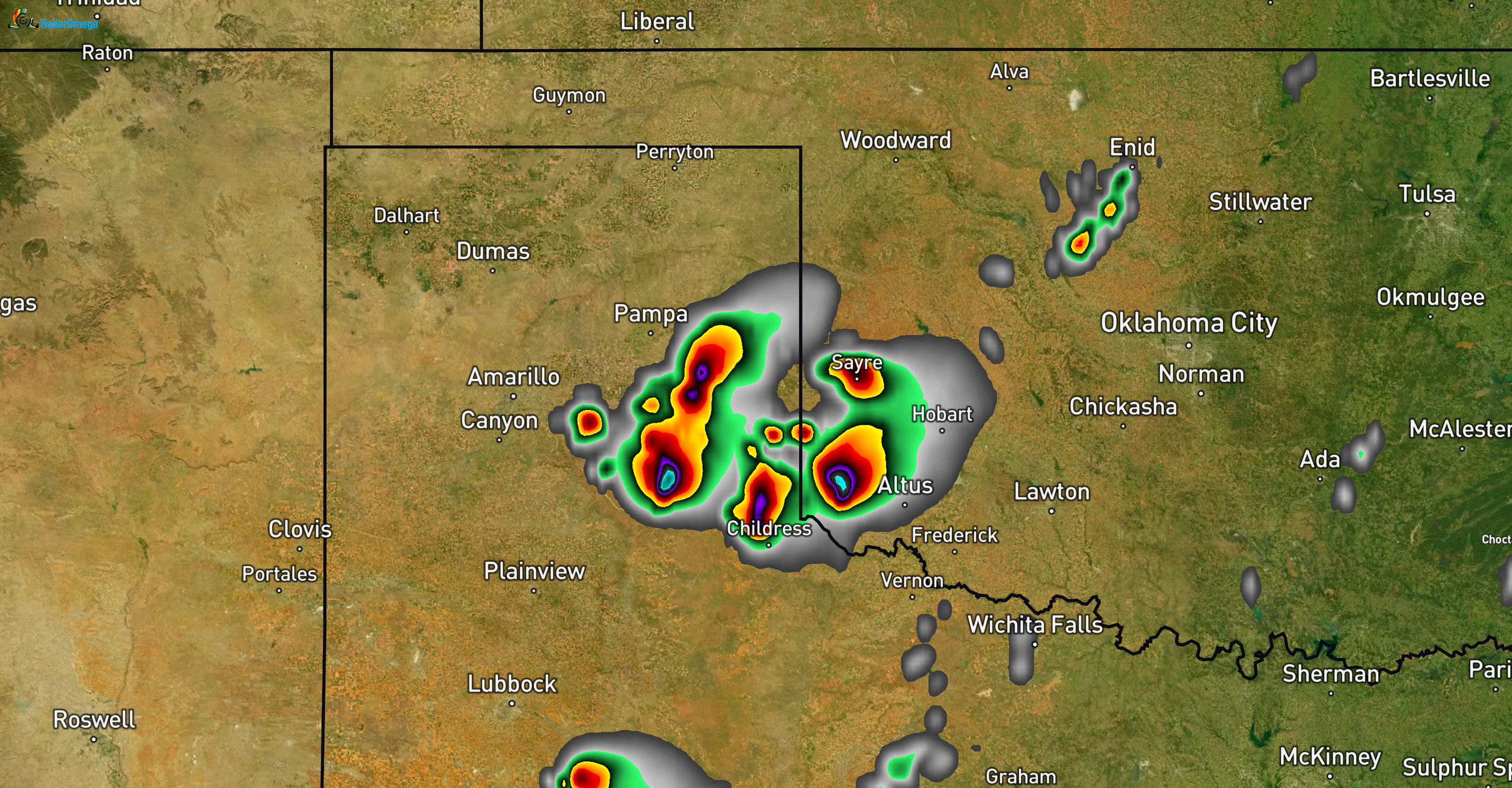
The team is in Elk City, OK this morning.
SPC Enhanced Risk (Level 3/5) eastern TX Panhandle into western OK.
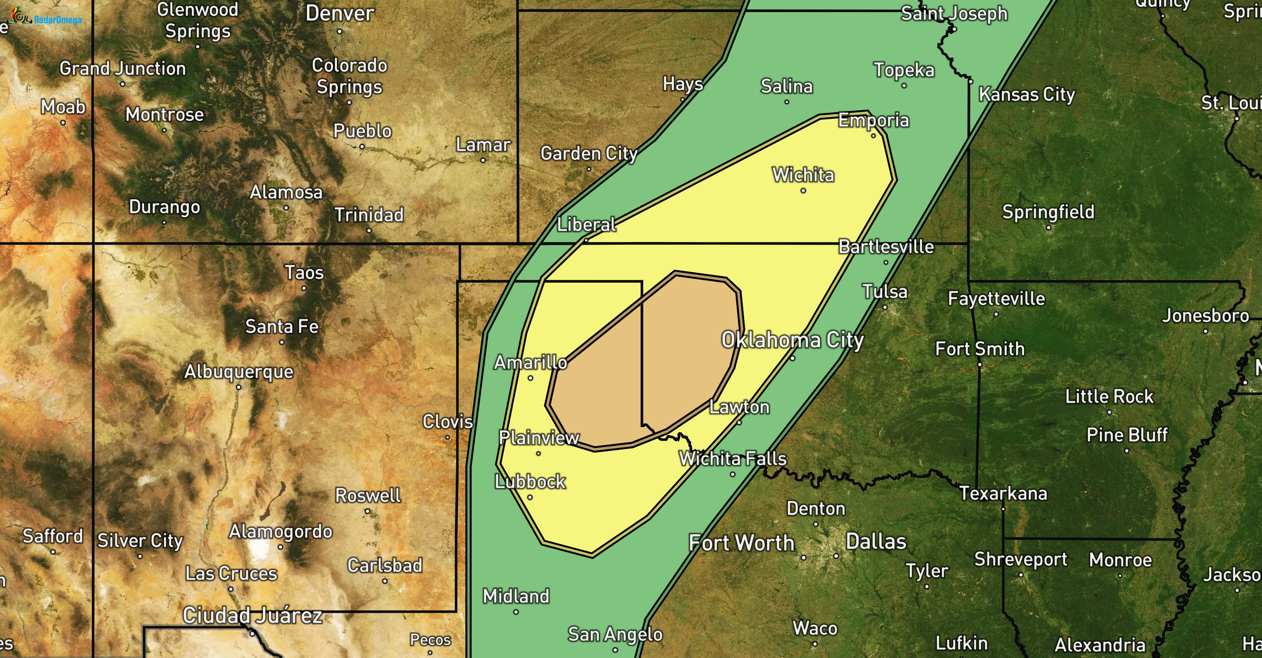
Scattered severe storms late afternoon/tonight from northwest TX/TX Panhandle into western OK, southern/central KS. Primary threats: very large hail (2-3 inch potential), a few tornadoes, damaging winds. MLCAPE 1000-1500 J/kg east of dryline, ~40 kt deep shear for supercells early. Evening low-level jet strengthens, boosting 0-1 km SRH for tornado risk. Storms likely upscale to intense cluster moving northeast.
Target today: enhanced zone, focus eastern TX Panhandle/western OK (Childress to Elk City corridor). Weather balloon launch (sounding) near Childress planned 1-4 pm for improved instability/shear profile. We need to be mindful of any isolated/’singular’ storm. It could be a supercell and produce a tornado, maybe even a big one. Here’s HRRR Model around 5-6pm.
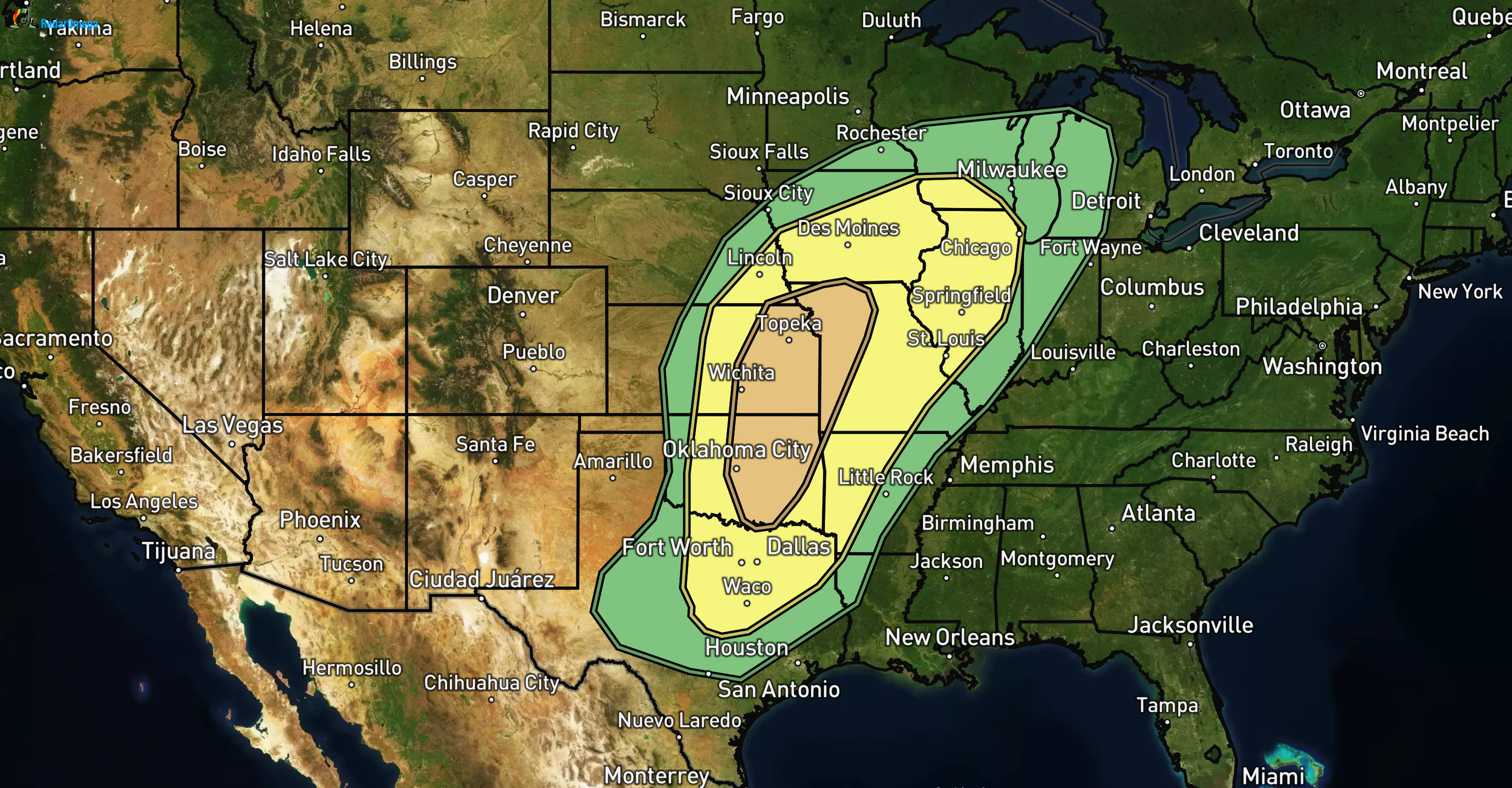
Tomorrow (March 6): Enhanced Risk shifts east/north (eastern KS/OK into western MO). Highest tornado risk all week, very large hail, wind potential. Level 3 of 5 on the tornado chance. Target northern OK or southern KS. Reposition today/tonight to be in position.
Extended: more severe potential after weekend.
GoFundMe at $21,000: massive thanks to all supporters! This directly funds probes, balloons, and data collection that improves severe weather understanding, warnings, and public safety. Your help is making a real difference.