
March 4 Operations Plan
Field Operations Team stayed in El Reno, Oklahoma last night and are waking up to a gloomy, cool start to the day. There’s an SPC Slight Risk (Level 2/5) covering north-central TX, eastern OK into Lower OH Valley. Isolated/scattered severe storms today/tonight.
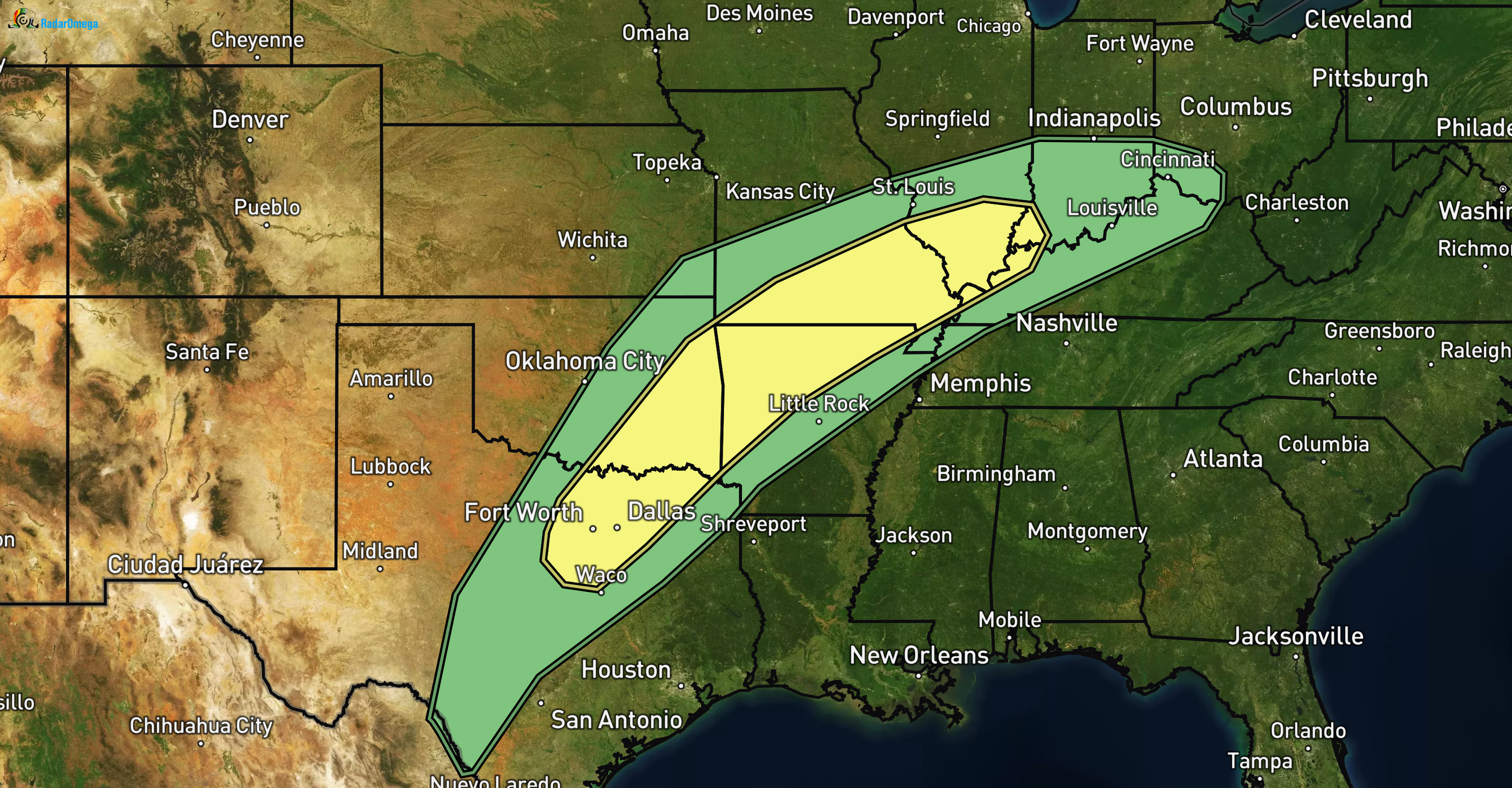
Main threats: large hail (up to half-dollar or bigger in spots), localized damaging winds (gusts ~60 mph), low tornado chance (2% hatched area). MLCAPE 1000-1500 J/kg near front, shear 35-50 kt effective bulk (strongest eastern OK/AR/MO/southern IL). Modest ascent, messy mode expected with clusters more than discrete supercells. Ongoing morning elevated storms in northern OK/southeast KS may limit heating downstream.
HRRR/RadarOmega shows messy, scattered convection, not highly organized. Best window this afternoon/evening along/south of front. Red River area (SE OK/NE TX, e.g., near Paris, Idabel, Texarkana corridor) stands out as potential focus for stronger cells.
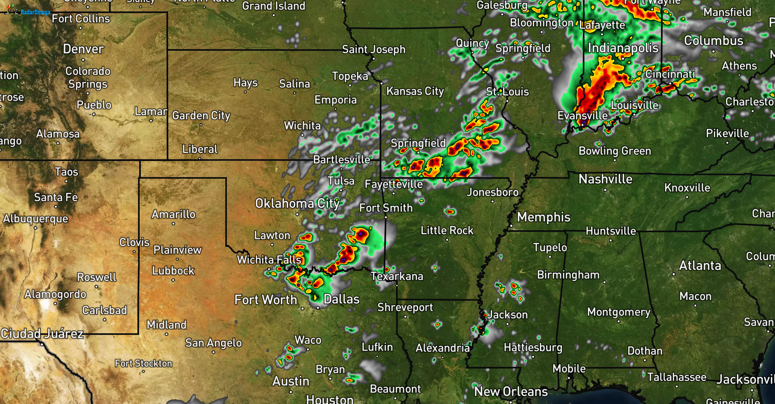
HRRR Model for 6PM
Today remains a garden-variety severe setup. Likely no soundings or probes planned, messy mode, pre-main season, and Thu/Fri look stronger.
Thursday (March 5): HRRR indicates nice storm cluster, potential supercells along dryline in eastern TX Panhandle/SW OK/western OK.
Target zone: Childress/Shamrock TX to Elk City OK area. Afternoon sounding planned there for better profiling/instability view. Handful of data probes for test deployment. All-hazards possible (hail golf ball+, winds 60+ mph, isolated tornado risk).
