
RISE-26: (high) Resolution Intelligence into Storm Environments
RISE-26, which stands for high Resolution Intelligence into Storm Environments, is an atmospheric research mission under Project WeatherEye, focused on defining the storm environment with unprecedented clarity. The mission is designed to advance atmospheric science, improve real-time situational awareness, and generate renewed interest and understanding in the meteorological sciences. RISE-26 combines advanced instrumentation, real-time environmental intelligence, and a multidisciplinary team dedicated to understanding severe weather.
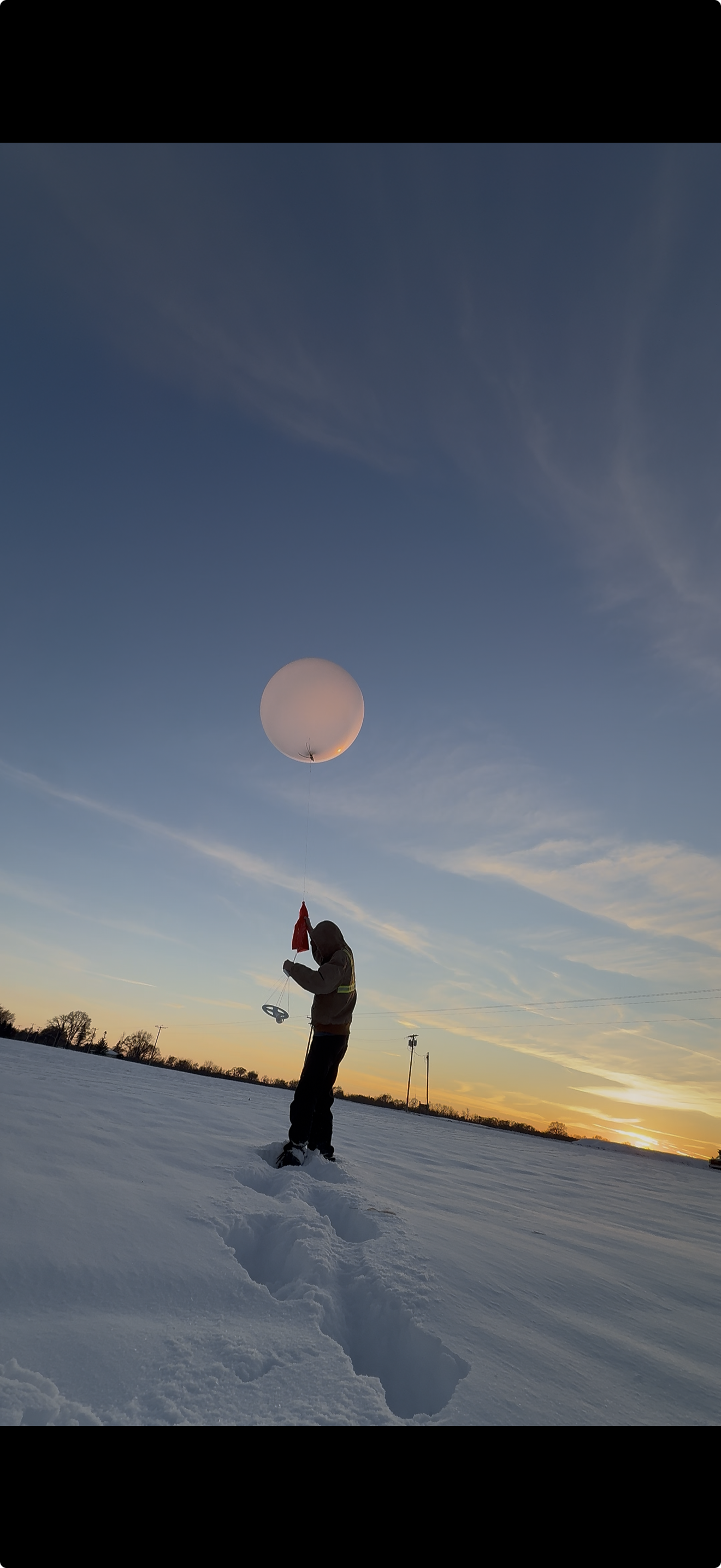
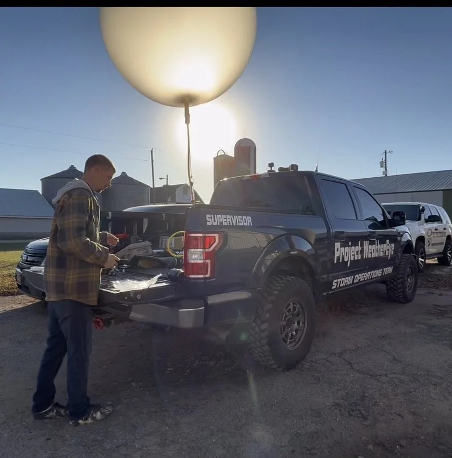
At the core of the mission is the RISE-26 Upper-Air Program, which launches weather balloons carrying high-resolution radiosondes that transmit new atmospheric data every one second. These soundings are routed directly to RISE-26 servers for immediate processing and instant visibility, allowing anyone to watch the atmosphere evolve in real time and enabling more precise assessment of severe weather potential. In addition to upper-air observations, RISE-26 incorporates a focused and targeted ground-based probe network, a coordinated storm chaser team, and a distributed live video grid that together create a unified real-time depiction of the storm environment from the surface to the upper atmosphere.
The mission is powered by meteorologists, engineers, data analysts, developers, researchers, and storm chasers working collaboratively to advance severe weather understanding and real-time awareness. Field operations, launches, and probe deployments are live-streamed to provide transparent insight into both the atmosphere and the science behind the mission. Partial operations are planned to begin in April 2026, with full operations expected in May and June, with timing adjusted as needed based on severe weather forecast expectations. Universities, research groups, and public-sector agencies interested in accessing RISE-26 datasets may request access through our website.


Our mission relies heavily on your financial support. Consider using our GoFundMe to support the cause.
As you can imagine, the costs of not only supplies and critical components such as radiosondes, weather balloons, helium and hydrogen gasses, but man power and fuel for vehicles runs up yearly operating costs to nearly $200,000!
The $25,000 GoFundMe goal is one small, but critical piece of the puzzle that really helps us progress forward so quickly.
Our services help progress meteorological research and provide ground (and sky) truth data to help us better forecast severe storms. There are no other crowd-funded operations doing this. We’re a unique system that puts trust in our audience to help us achieve results that they will be proud to support.
If you’re able to pitch in, you’re helping directly fund this science mission. We’re also writing the names of all channel members, long time viewers, and supporters on the radiosondes we launch into the stratosphere! Each launch has 5 names written in marker before releasing the balloon.
4 Branches Make Up RISE-26
-
Upper-Air Program
RISE-26 delivers one-second atmospheric updates, live from the ground up, providing high-resolution real-time soundings from the exact locations where storms draw their air.
These observations reveal whether deep moisture and instability will support large hail or tornadoes, the height and strength of temperature inversions that suppress or suddenly release convection, and the magnitude and depth of wind shear and directional turning that organize and rotate supercells.
One-second sampling through the lowest miles of the atmosphere captures critical details minutes to hours before storms intensify. Weather balloons routinely ascend to 100,000 feet while transmitting temperature, dewpoint, pressure, and wind data every second, allowing the complete atmospheric profile to build instantly as the data streams live.
This capability is enabled by custom ground receivers designed and built in-house by the WeatherEye team, which capture every packet and push the full dataset to the cloud in sub-seconds with no recovery required and no delays.
Live on wxeye.org, users can view an interactive skew-T updating in real time, track the balloon’s GPS position on a live map, and access severe-weather indices calculated instantly using proprietary algorithms, including CAPE, CIN, 0–1, 0–3, and 0–6 kilometer bulk shear, 0–1 and 0–3 kilometer storm-relative helicity, effective storm-relative helicity, low-level lapse rates, and storm motion.
Complete soundings can be exported with a single click in CSV, BUFR, and other standard formats for immediate use in external research and modeling tools. Most launches are also video streamed from fill to burst, allowing researchers and the public to watch the atmosphere reveal itself in real time.
-

Ground-Based Network
RISE-26 deploys 20 to 50 rapidly deployable surface probes across wide areas hours to days ahead of expected severe weather, creating a temporary high-density mesonet that samples the pre-storm environment at spatial scales no fixed network can match.
As storms approach, additional targeted probe clusters are placed directly within the inflow, forward-flank, and rear-flank regions of individual supercells. Each unit is approximately the size of a laptop computer and is designed for fast, simple deployment in the field. Probes transmit data every second, including temperature and dewpoint with 0.25 degree Celsius accuracy, pressure with 0.1 millibar resolution, and optional wind speed measurements with one-second gust tracking.
Battery life supports up to six continuous days of operation, making the system well suited for both multi-day high-risk outlooks and last-minute targeted deployments.
All data streams instantly via cellular and satellite connections to WeatherEye servers and appears live on wxeye.org with effectively zero delay.
Key advantages include 60-second deployment times, rapid retrieval and reuse, a real-time mesonet map that visualizes the evolving environment across hundreds of square miles, and one-click export of complete datasets in CSV and other standard formats for immediate research use.
This combination of broad-area pre-storm coverage and focused in-storm sampling reveals boundaries, moisture pooling, outflow interactions, and rear-flank downdraft evolution that ultimately drive severe weather outcomes.
-
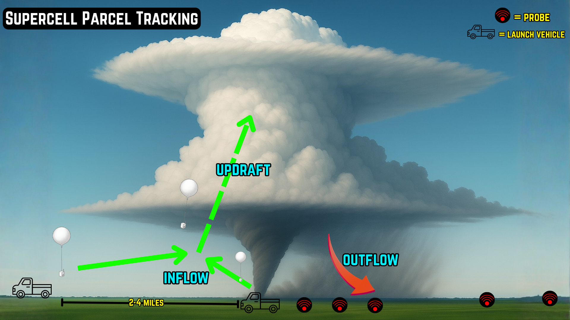
Storm-Scale Deployments
Under ideal conditions such as slow-moving, low-precipitation supercells and preferably tornadic storms, RISE-26 conducts targeted launches of small, lightweight balloons and radiosondes directly into a storm’s inflow notch.
These are not traditional upper-air soundings, but low-cost tracer balloons designed to be ingested by the updraft and carried within the rotating storm itself. Each compact sonde continuously transmits precise GPS position in both horizontal and vertical dimensions, along with wind speed, wind direction, and pressure.
These tracer balloons are not intended to reach high altitude. Their sole purpose is to follow storm-scale inflow parcels from the surface into the updraft and mesocyclone, providing the first direct measurements of the air that actually feeds a tornadic supercell.
The system is built around rapid, repeatable launches using inexpensive hardware, with the same custom WeatherEye ground receivers capturing every packet and pushing data to the cloud in sub-seconds.
Real-time three-dimensional parcel trajectories are displayed live on wxeye.org with radar overlay, and complete datasets are made available immediately in CSV and other standard formats.
These targeted launches occur only when storm motion, structure, road network, and safety considerations align perfectly, and activation of this mission component is determined on a case-by-case basis.
-

Live Video Grid
Visual verification is provided in real time through a distributed network of dedicated live video cameras that deliver continuous high-definition streams from multiple strategic positions around active severe storms.
These cameras provide simultaneous, ultra-low-latency views of the storm base, inflow region, wall cloud, precipitation core, rear-flank gust front, and any tornadoes, offering essential visual confirmation that directly complements radar and in situ atmospheric data.
The system is built around rapidly deployable, weatherproof camera units capable of streaming continuously for up to five days on battery power, with multi-carrier cellular uplinks that ensure reliable feeds from remote Plains locations.
Geo-tagged camera positions are displayed live on radar for immediate spatial context, and complete event archives are made available shortly after each deployment.
Live video is not merely for presentation, but a core scientific requirement that confirms radar signatures, documents storm evolution, and provides ground-truth imagery critical for research and operational forecasting.
Purchase RISE-26 Branded Items
Logo Sticker

T-Shirt w/Logo

Hat

Hooded Sweatshirt w/Logo

Digital Text Shirt

Long Sleeve Shirt w/Logo