
April 2, 2026: Pre-Season
Today is an easy day to get out and do a final test of equipment and procedures for the 2026 season! Peak season starts pretty much as soon as a week or so from now. RISE-26 is ready!
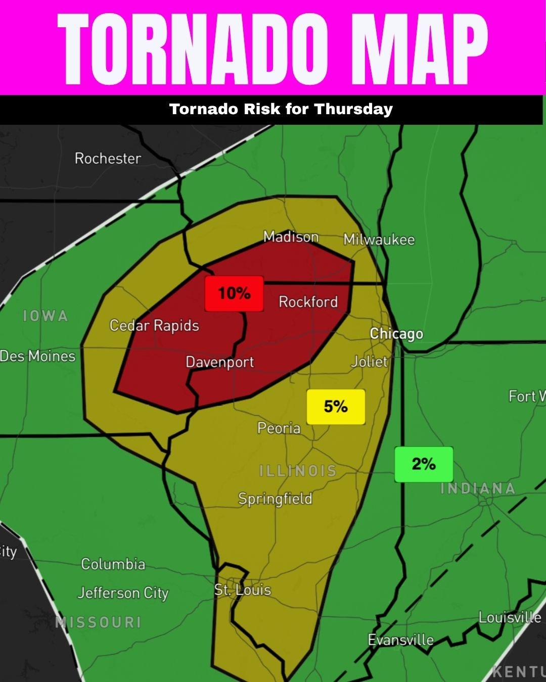
LEVEL 3 OF 5 RISK: Iowa, Illinois, Wisconsin.
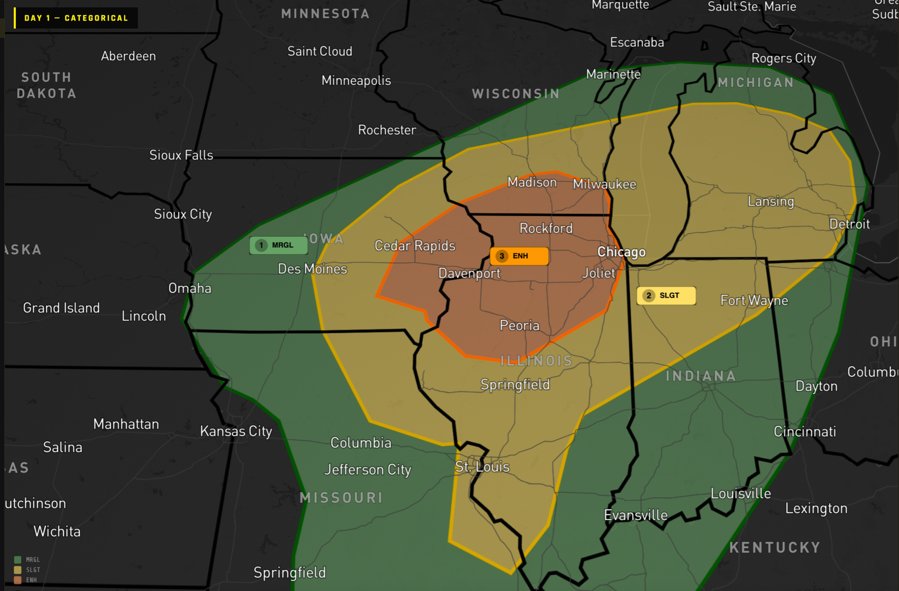
SPC Day 1 Outlook
The SPC summarizes that a trough will quickly move northward through the Plains and across the target area today. A modest surface low will race northeast from north central Kansas this morning into Ontario by Friday morning. A warm front will lift northward across the area during the day and a north south cold front will push east across the region during the late afternoon and overnight.
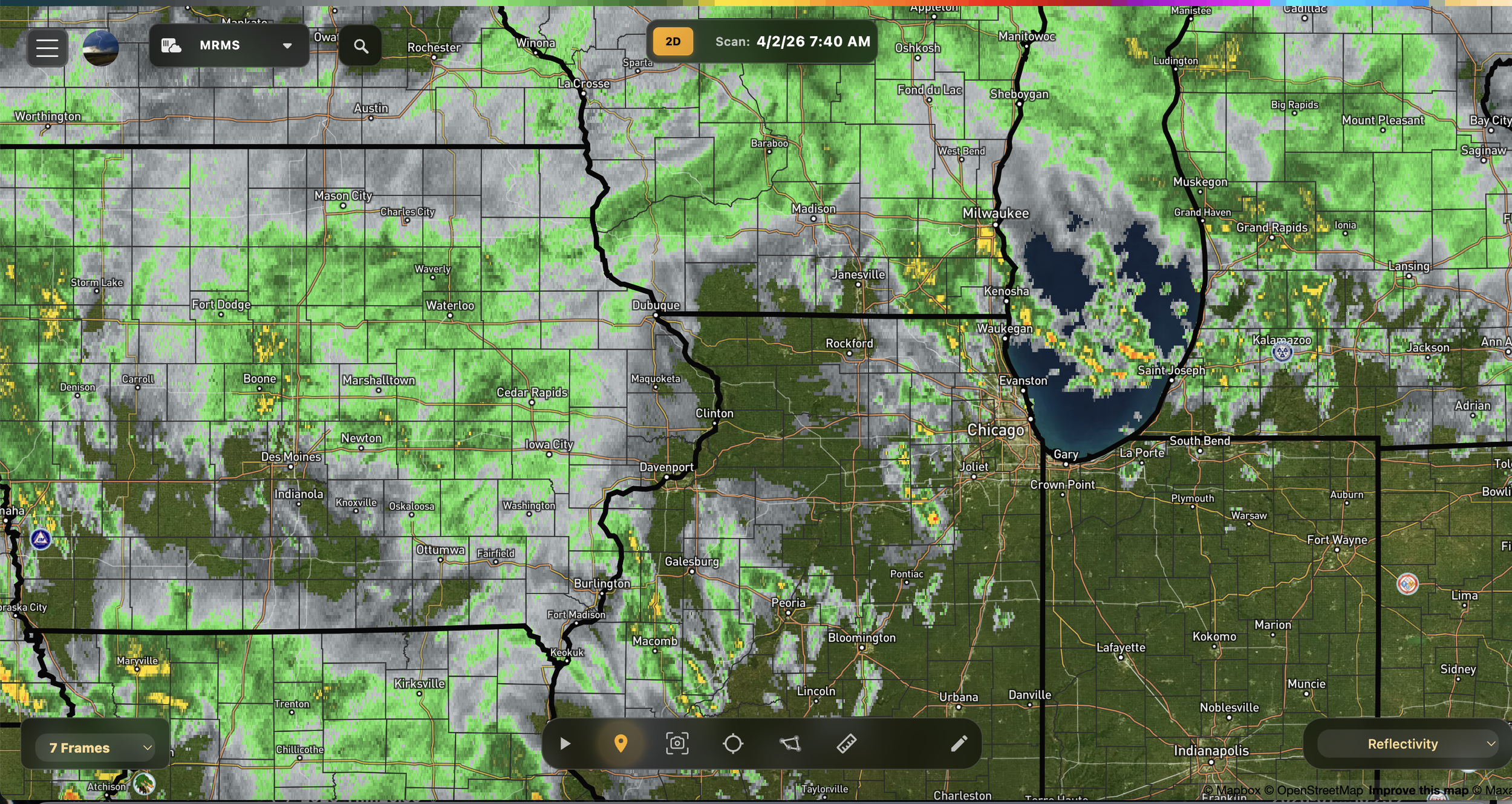
Radar (above) shows lots of showers spread wide across the risk area as of 7:40am. These are expected and should clear out just after lunch, leaving just enough time for instability to build in. *If they hang around all afternoon, expect severe weather risk to go down, but unlikely.
In the wake of the morning early afternoon convection a narrow corridor of destabilization should occur across central eastern Iowa and northwest Illinois to the south of the warm front and east of the cold front. Scattered supercells are expected to develop along the cold front during the afternoon where MUCAPE exceeds 1000 J per kg and deep layer shear is around 45 knots. Strong low level kinematic fields will support a tornado and wind threat with these initial storms. Supercells in this modestly unstable environment will support some hail potential, but the main focus is the tornado risk! Big or strong tornadoes are certainly possible, but watch out: they could be moving 40-50mph to the northeast!
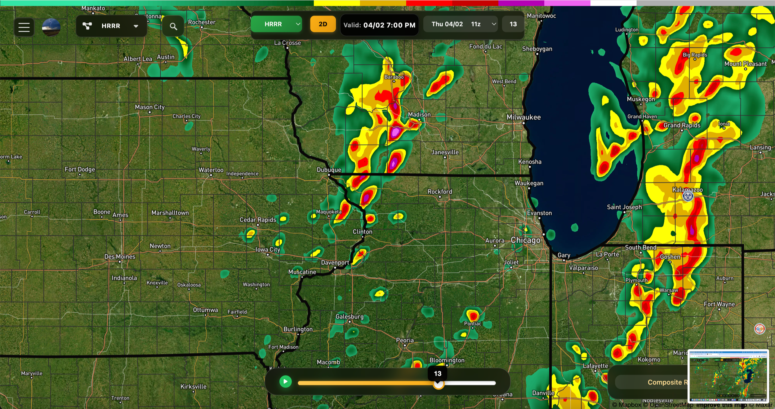
We’ll need to be paying most attention to that cluster of storms coming out of eastern Iowa around 3-5PM….
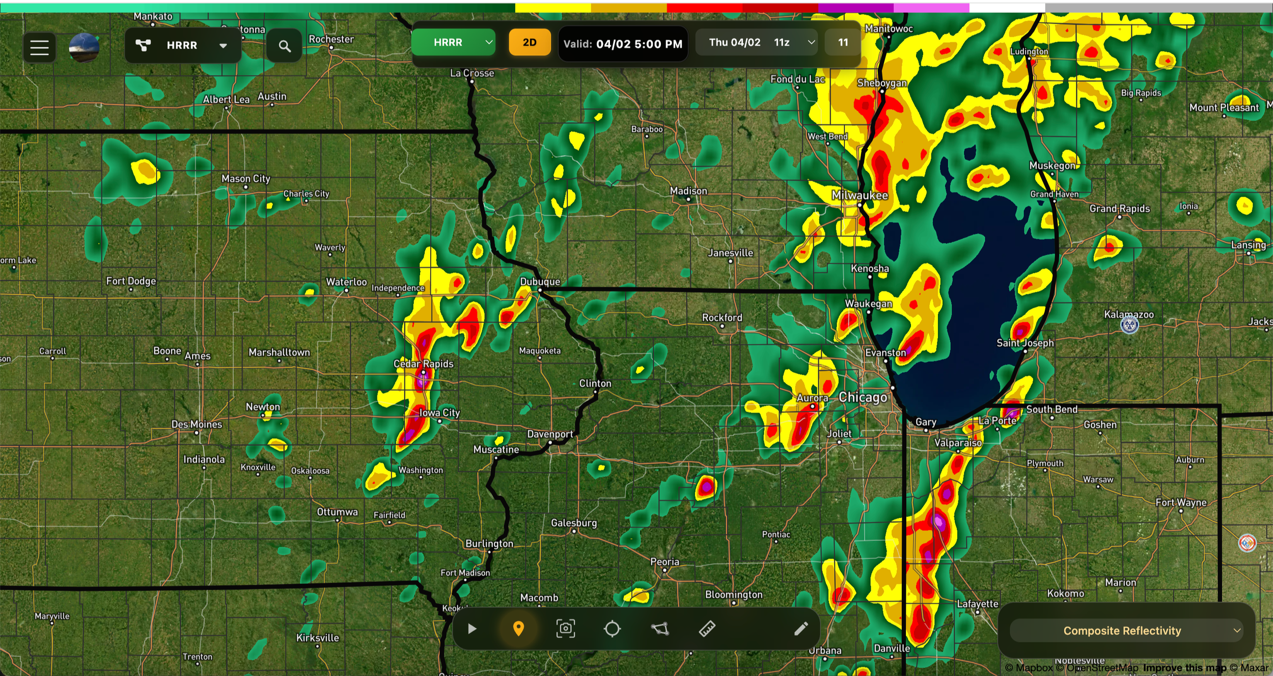
5PM HRRR
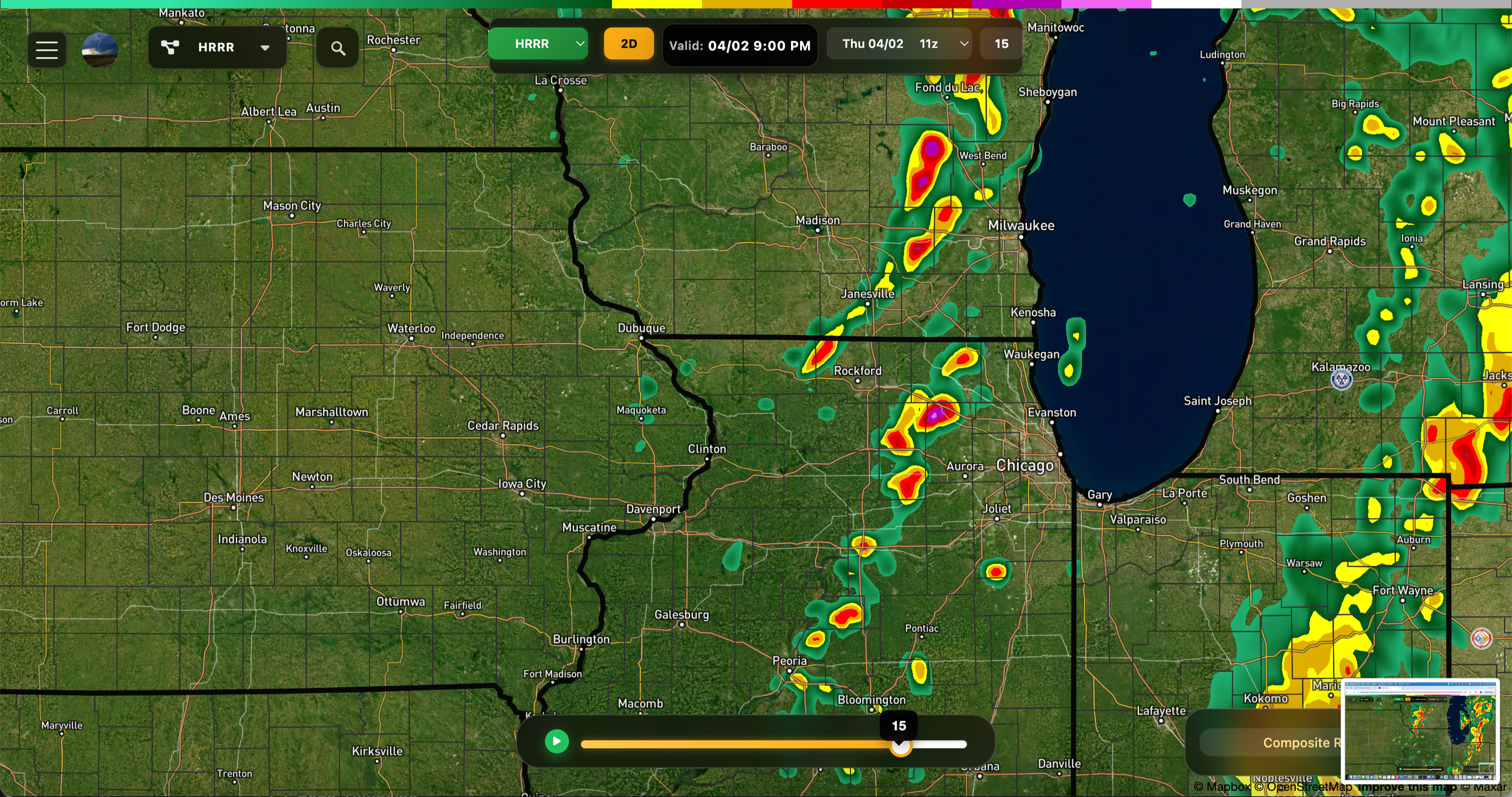
And also as they move into Wisconsin…
7PM HRRR
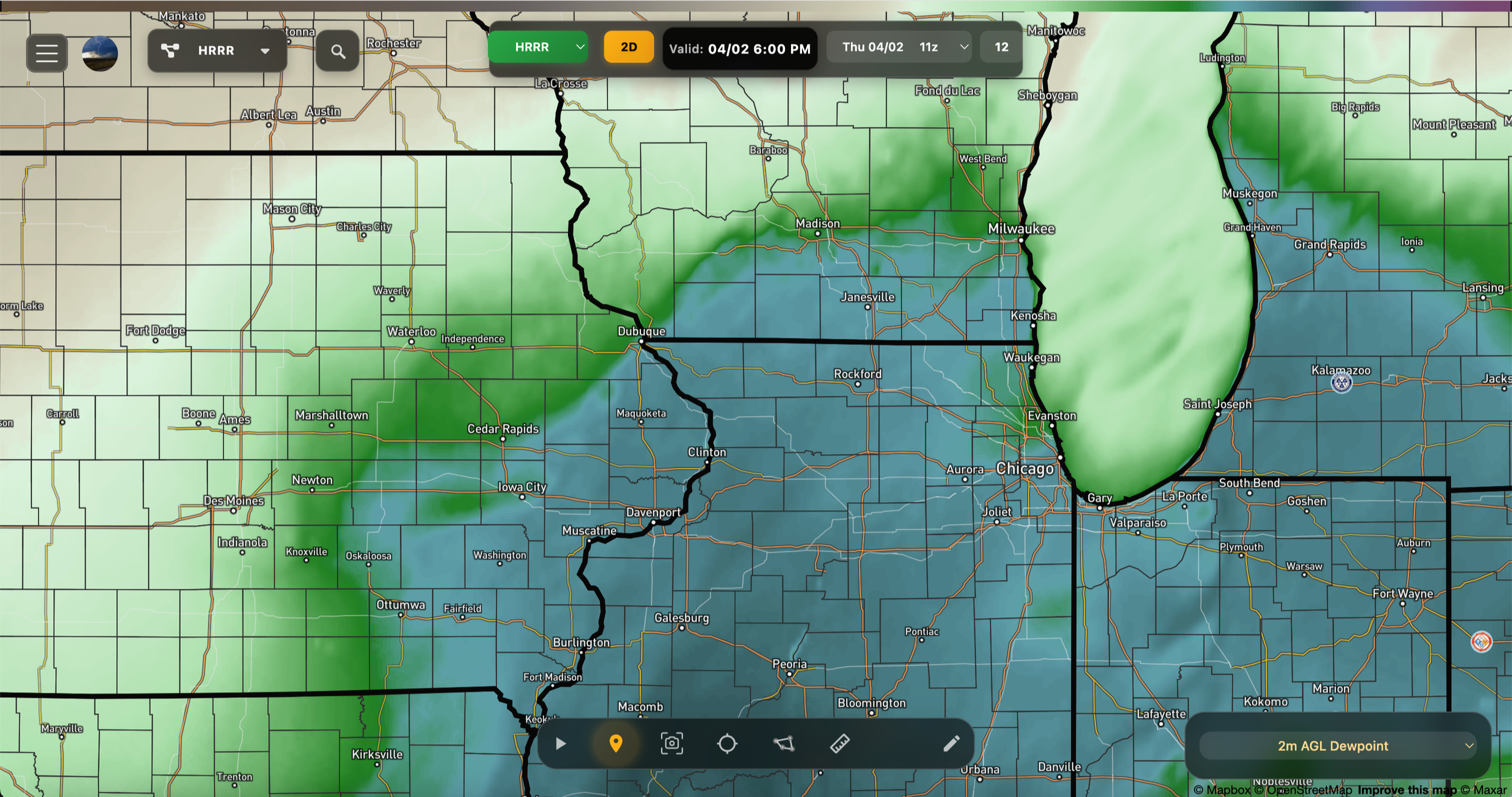
Plenty of moisture, shown on the HRRR below, will give these storms ample fuel. Notice the dry air (grey/brown) to the west meeting closely with the moist (blues/greens) to the east. That’s where our storms will be.
By late afternoon early evening these supercells should move into a less stable environment with decreasing CAPE but increasing low level shear. The initial discrete storms will eventually grow upscale into one or more linear segments along the advancing cold front. Despite decreasing instability the strength of the low level wind field will support a continued wind threat eastward into Lower Michigan during the evening and overnight hours.
RadarOmega future radar for 9PM
RISE-26 is planning a small scale operation which may include. a few probe deployments, but certainly a sounding. Expect a weather balloon launch sometime around 12pm to 3pm CDT from eastern Iowa. You can view the data as it comes in live on WxEye.org’s home page. Look for the sounding widget. You can also watch 3 live streams: