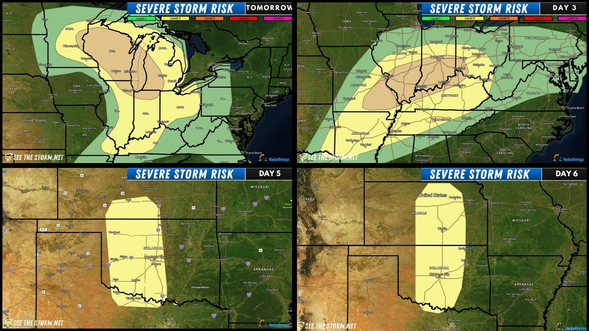
May 14: Enhanced Risk Tomorrow
Active severe weather returns for the remainder of May! We’re expecting strong thunderstorms in Wisconsin tomorrow. A level 3/5 (enhanced) risk has been issued by the SPC, and there is mention in the official forecast that a few strong tornadoes may occur, as well as big hail (up to 3" inches) and extremely strong winds, which may gust up to 80mph! Project WeatherEye will be in full force for this event.

An upper low-pressure center over the Dakotas and a shortwave trough will move northeast, while a secondary jet streak from the southern Plains to the Ohio Valley amplify the system. At the surface, a warm front will lift northward and bring a moist and very warm air mass to the severe weather outlook area. A dryline, which is the division of moist and dry air masses, extending south from the low will track across Iowa, Minnesota, and then east.
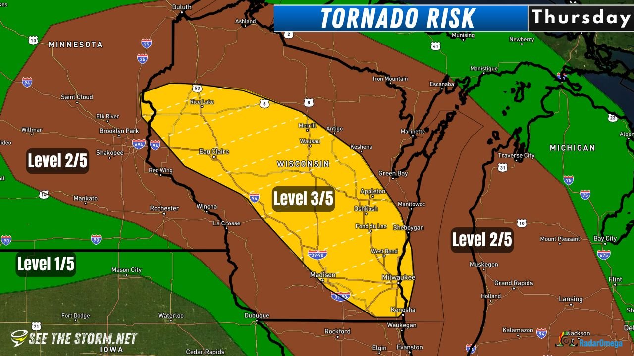
The SPC tornado probabilities below highlight the corridor from Eau Claire to Kenosa, Wisconsin.
We’ll take a look at some of our severe weather parameters to determine a target area.
We’ve got ample moisture, with dew points forecast to be around 65F-70F in southern Wisconsin and northern Illinois. You can also probably pick out that sharpening transition from the moist airmass to the dry airmass, oriented from about Minneapolis to Cedar Rapids to St. Louis. This area could be a focal point for storms to begin to form!

Supercell Composite Index is highest along and east of I-39/90 in the early evening. This model is a blend of many different variables and models brighter colors and higher values where those variables overlap, giving us a good “at a glance” idea of whether an environment may or may not be favorable for storms.

Future radar from the HRRR model likes the area from the Interstate 39/90 split north of Madison to Appleton in the evening. It doesn’t even show storms down in Illinois. Be cautious of this, as it’s wrong almost as often as it’s right, especially over 24 hours away.

With this information, we’ll consider WeatherEye deployment anywhere from Eau Claire, WI to as far south as Peru, IL, but we’re really preferring the area in southern Wisconsin.

Looking ahead, Friday, Sunday and Monday will likely all have severe storm chances, but we’ll wait until tomorrow to focus on those!