
May 24: Returning to Oklahoma
May 22, 2025 Small Deployment
On Thursday, we deployed RDD-2 and RDD-5 near Archer City and Olney, Texas as this huge, rotating supercell passed thru the area!
Today

A cluster of thunderstorms is currently impacting eastern Oklahoma this morning. This cluster is expected to move east-southeast into the ArkLaTex through early afternoon, posing a threat for scattered severe winds and some hail.

RadarOmega Visible Satellite showing thunderstorm activity this morning.
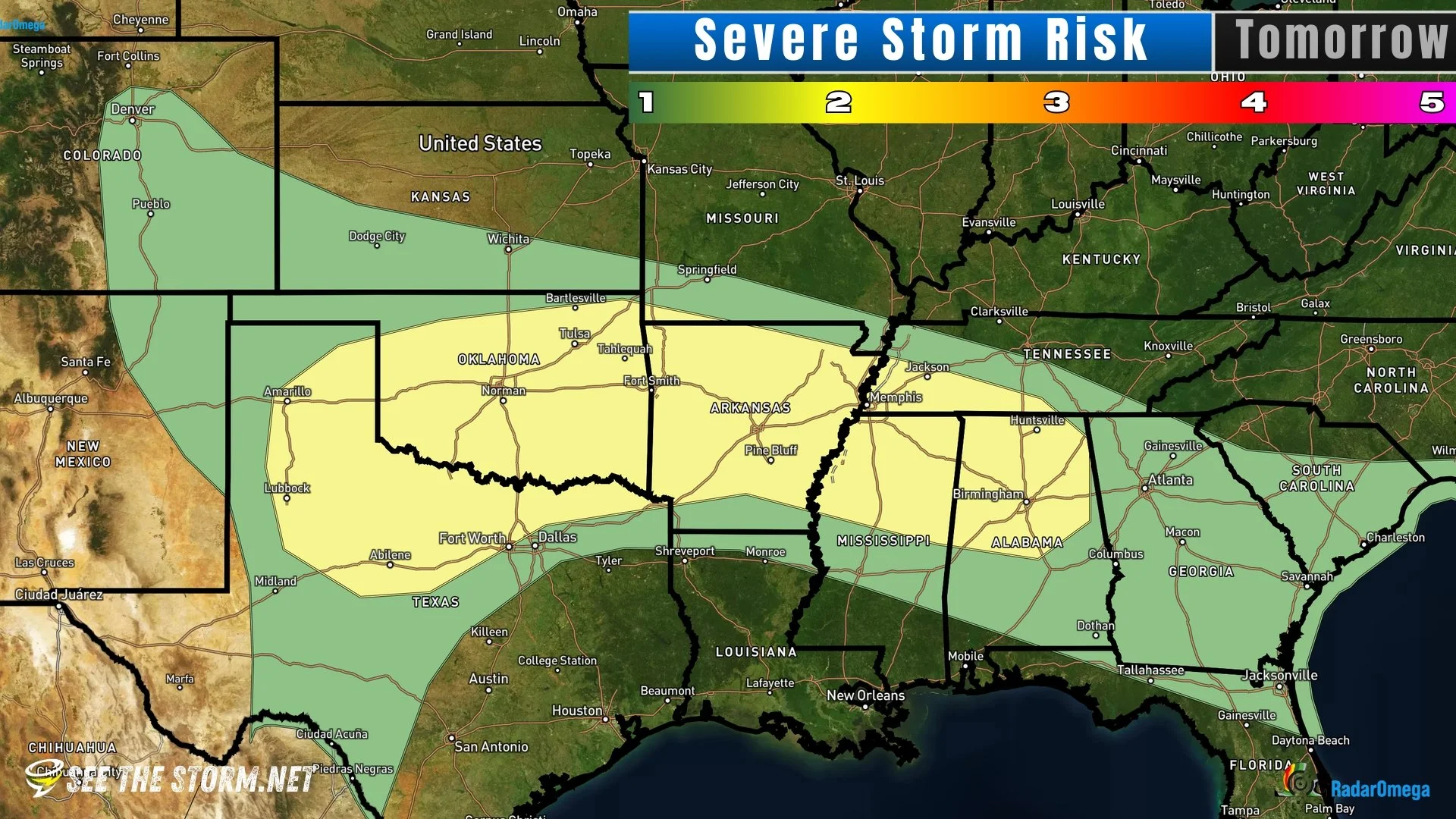
Behind this morning cluster of storms, a very unstable airmass is forecast across the southern Plains this afternoon, east of a dryline and south of a convectively reinforced front. While widespread storm development may be somewhat limited, any convection that forms along the dryline or front in western/central Oklahoma could become severe. High instability and sufficient shear would support supercells capable of producing very large hail and a few tornadoes.


A big question mark is: Why aren’t most convective models showing storms form on the future radar composites? Who knows, could be capping issues, but don’t put too much faith in the model on this scenario.

*Note: Would not be surprised to see parts of the outlook area upgraded to level 3/5 (enhanced) if confidence in storms developing increases.
Sunday
Along a front extending from central Oklahoma to a low in west Texas, extreme amounts of storm energy are expected! Late afternoon storm development along this front could producer rotating supercells, containing big hail and maybe tornadoes!

Enlarging the Fleet!
This weekend, we’ll be adding RDD-6 and likely RDD-7 to the fleet, as well. Zach from Tennessee Storm Hunters will be joining the Field Team. He’ll be out in the Plains for the next few weeks, but frequently is active in southeast US severe weather events. Follow Zach: https://linktr.ee/tnstormhunters
This splits up the equipment between 3 staff members and allows for larger areas to be covered.