
May 22: North Texas (If we make it)
A dynamic weather setup is unfolding across the southern Plains this afternoon and evening, with the potential for severe thunderstorms. The primary problems include large hail, with some stones possibly exceeding 2 inches in diameter, and strong wind gusts. The Storm Prediction Center has highlighted parts of Oklahoma and Texas as areas of concern.

A weather front, currently draped across Oklahoma, is expected to drift southward over the Texas South Plains and southern Oklahoma by late afternoon. South of this boundary, intense daytime solar heating will create an unstable airmass. Scattered thunderstorms are likely to develop and intensify in this environment, fueled by steep lapse rates and shear near 40 mph. Wind profiles and hodographs indicate a favorable setup for supercells, which could produce very large hail in the dominant updrafts. Severe wind gusts are also possible, particularly with downdrafts. As the evening progresses, these storms may organize into a couple of thunderstorm clusters, moving into northwest and north-central Texas.

RadarOmega Future Radar (HRRR) For Tonight at 6PM Central
Our Plan for Today
The Project WeatherEye Field Team is currently staged in Oklahoma City, targeting North Texas and the Red River region for today’s chase. However, we’re waiting in line for 4 new tires. We’re working to have all four tires replaced by 1:00 PM CDT, after which we’ll head south. This delay may impact our ability to deploy Project WeatherEye’s equipment in time to capture today’s storms, but we’re keeping our options open and will assess opportunities as we move into position.
Our focus remains on safety and strategic positioning to document and study these powerful storms. We’ll provide real-time updates on our progress via our social media channels, so stay monitoring for the latest.
Looking Ahead: Friday’s Potential Chase
While today’s setup is promising, tomorrow may offer an even more compelling opportunity for storm chasing. A relatively flat ridge will dominate the central Rockies, with flow over the higher terrain driving lee cyclogenesis across the central High Plains. A dryline will extend from a surface low in western Kansas through the Texas Panhandle and West Texas, setting the stage for severe weather.
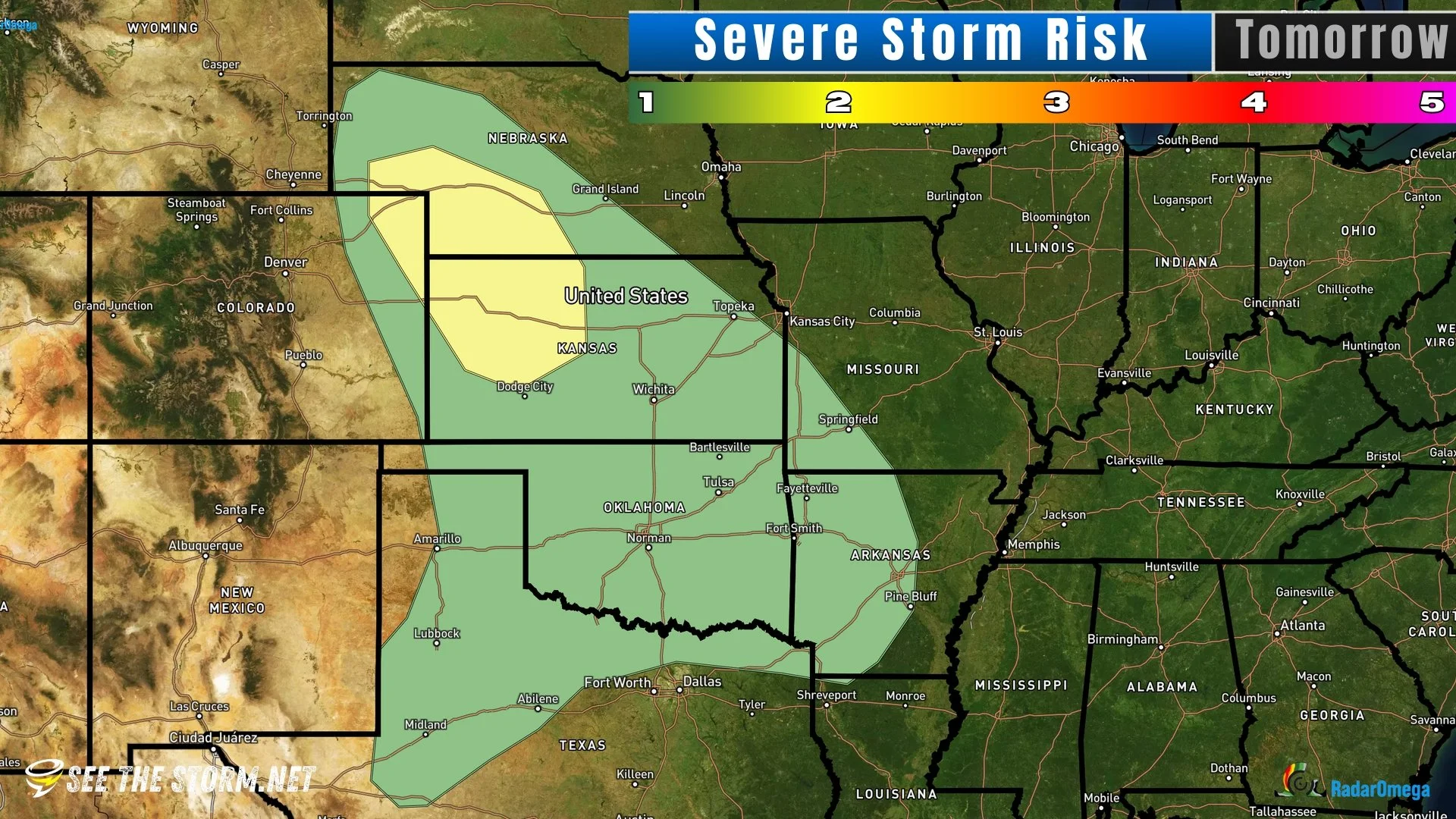
Strengthening southerly flow will enhance boundary layer moisture ahead of the dryline, particularly across northeast Kansas. This will foster moderate instability, with steep lapse rates from the surface to the mid-levels in the strongly mixed zone along the dryline by mid-to-late afternoon. While upper-level forcing may be somewhat diffuse, increased isentropic ascent and upslope flow should trigger scattered storm development during the evening. Strong shear will support supercells capable of producing large hail and severe wind gusts.
This setup suggests a potentially active chase day, and we’re already planning to reposition the team to capitalize on these conditions. We’ll share more details on our target area and strategy as the forecast evolves.
The future radar model below sure looks promising…

RadarOmega Future Radar (HRRR) Model for Tomorrow at 7PM Central.