
April 27: Unknowns
There’s a huge slight risk (level 2/5) for severe storms across the middle of the US today.

The dry line (leading edge of the dry, western air meeting the moister eastern air) could be the focal point for severe weather, including tornadoes. However, not really any of the reliable convective models are initiating storms. The overall environment is prime for severe weather, but without any model support, it’s hard to jump on board with any sort of confidence in severe storms today. Should storms fire up, they’d probably be most robust in western Kansas.
For us, it’s a 50% chance of a live stream. There’s a huge level 4/5 risk tomorrow in Iowa, Minnesota, and Wisconsin that we can not jeopardize. Strong tornadoes are possible, so it’s very important to ensure we have enough travel time to get there safely and well rested. Should today look more likely to produce storms, we can take a detour to investigate, but otherwise, you won’t find anyone here sitting in western Kansas under blue skies for very long.
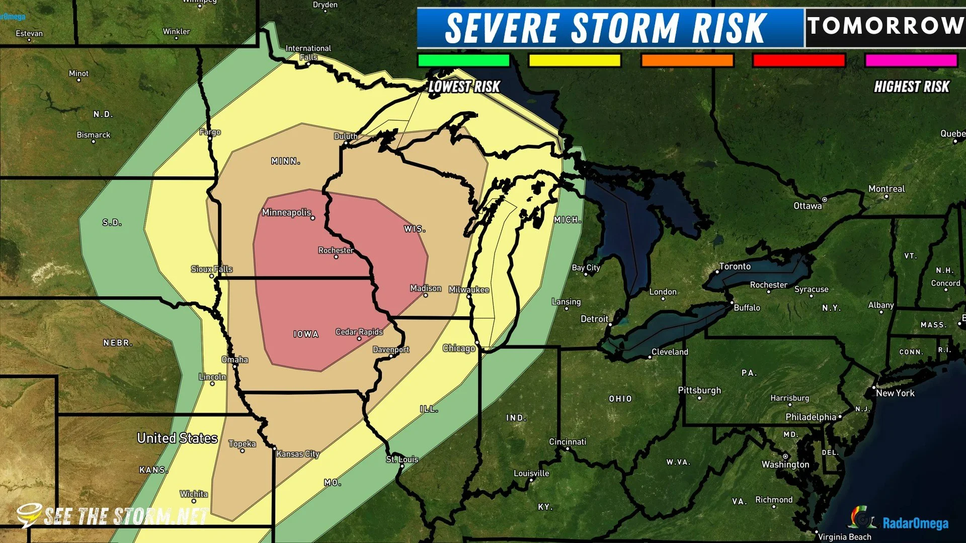
Some of the convictive models we use don’t even fire storms tomorrow yet, but it’s unlikely that will be the case. Anyone in the red area on the above map needs to be extra prepared for tornadoes and severe weather in general. Looks like we’ll be in a good position for deployment of Project WeatherEye as long as we can get to north east of Des Moines, Iowa, by about 3PM tomorrow.
Yesterday
We followed this incredible storm from New Mexico to almost Fort Stockton, Texas. Take a look at the timelapse video at the very bottom of the page.

