
April 23: More Fort Stockton!
We’re on the road again today, but first:
Yesterday, our WeatherEye team pursued a series of storms near Fort Stockton, Texas, under a Slight Risk (Level 2/5) from the Storm Prediction Center (SPC).

RadarOmega: Tuesday’s Risk Area
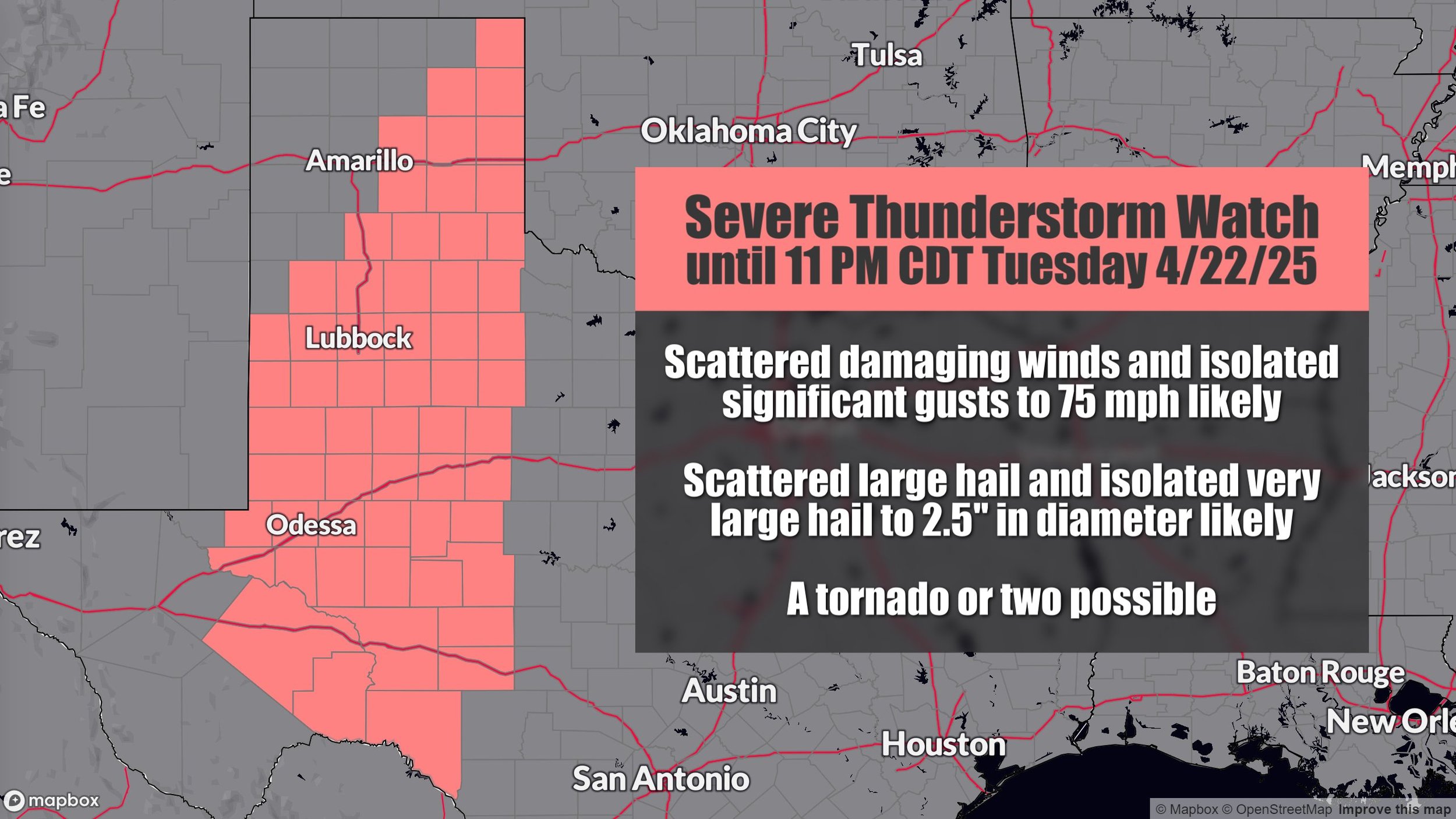
RadarOmega: Severe t-storm watch
A Severe Thunderstorm Watch was later issued as storms developed. Despite limited moisture leading to high-based storms, several made attempts at producing tornadoes, creating a visually spectacular day.
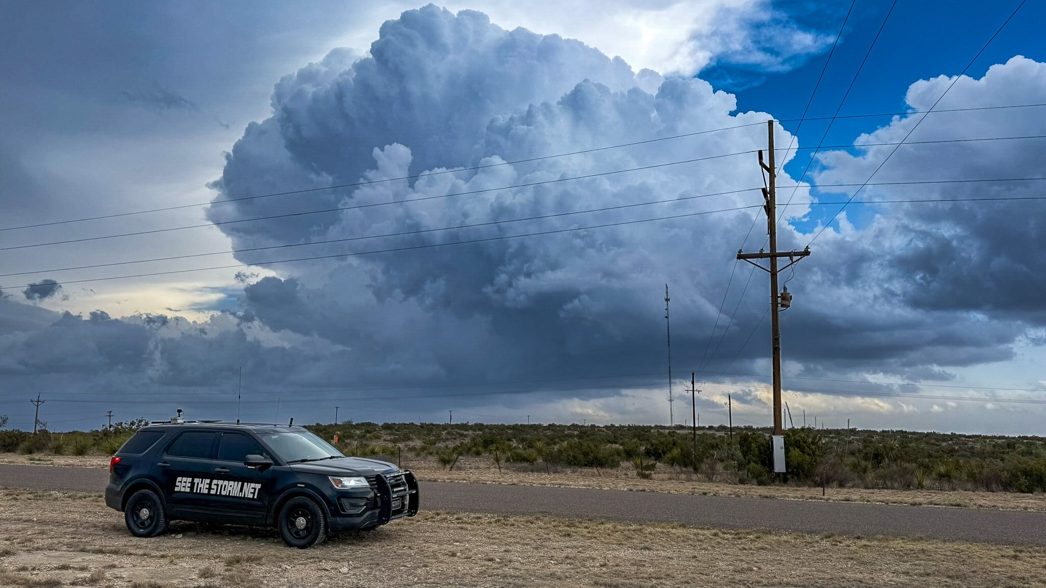
We strategically deployed RDD-4 south of Odessa, Texas, anticipating storms would track over the area. While the storms stayed just south of our position, RDD-4 still captured views from the north.

Meanwhile, RDD-2 was positioned along Highway 67, west of Fort Stockton, in front of a highly photogenic storm. Tasked with monitoring for tornado activity, it recorded an impressive time-lapse as we chased another storm south of town. See the clip below from RadarOmega.
The southern storm stole the show, earning a tornado warning. Although we observed no confirmed tornadoes, the storm’s structure and vivid visuals were breathtaking. Check out our gallery below for highlights from the chase!


Flood
Not to anyone’s surprise, this flash flood was located west of McCamey, Texas on the way to retrieve the RDD units. These are very common in this part of Texas. It’s not an uncommon thing to have several feet of water across parts of the road along the way.
Now, Today…
Today, we’re back in the Fort Stockton area with another SPC Slight Risk (Level 2/5) in place.

Conditions are primed for storm development, though the sparse road network poses a challenge. The open terrain and scenic views make this a prime chasing ground. The HRRR model suggests storm clusters will intensify around 6 PM local time, likely south of Fort Stockton. Unfortunately, these storms may push into areas with even fewer roads, complicating things a bit.
Large hail and strong winds are the primary threats today, but we can’t rule out the possibility of a tornado. Our team is ready to adapt to the dynamic conditions and capture the action.

Tomorrow’s Plan: Heading to the Texas Panhandle
Looking ahead, we’re eyeing a shift to the Texas Panhandle near I-40 for tomorrow’s chase. The SPC has issued a Marginal Risk (Level 1/5), with the potential for supercells risk in this region. An upgrade to level 2/5 would not surprise me. We’ll be repositioning to maximize our coverage of any developing storms.