
April 17: Deployment Intentions
Today looks like a pretty low-risk high-reward situation, for severe weather streaming anyway. If you’re a resident of the Omaha region, it means you might see some pretty big hail later, so in your case, maybe not such a ‘reward.’
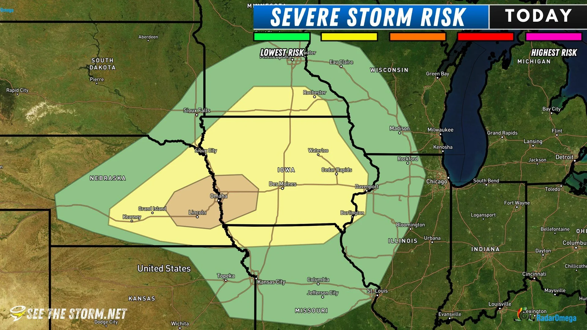
Before we get into it, seriously, if you live in the enhanced / level 3 of 5 risk, which is basically Omaha, please make sure your cars and anything prone to hail damage are taken care of and put away when storms roll thru. This could be a disaster for Omaha if a large hail producing supercell spins over town. Major damage to vehicles and roofs could occur, and due to the high population center, this could actually be a very expensive disaster!
SPC: Today

SPC: Today (Zoomed)
As you can see, the Storm Prediction Center, who draws up the risk area maps, has made it pretty obvious where the greatest severe storm chance are today. If we take a look at the HRRR future radar model in the RadarOmega app, we can note one cluster of storms likely forming around 5-6pm west of Omaha, near Columbus, extending up toward Norfolk.

HRRR at 6PM (RadarOmega)

That storm then drags, miserably, across the Omaha region and pretty much straight east along I-80 by 10PM. Des Moines, Iowa: you could see this roll thru around or just after midnight! It won’t be as strong, but if it holds together, expect it regardless!
The Plan
Vince & Aidan will be in the field for this event, with a general target area of around Omaha. 4 WeatherEye devices are along for the ride, too. There’s actually 5, but RDD-5 does not have a handle installed yet, so that one being up and running is dependent on the next hardware store run.
A day like today, where a single, dominant storm is likely to track across a fairly well predicted area is a perfect day to deploy 1 or 2 Rapid Deployment Devices out ahead of the storm. We’ll probably consider deployments in far western Iowa, near Omaha.
Storms should also be very photogenic today, thanks to a little bit of dry, stable air near the surface. There isn’t enough to stop storm development, but there’s enough that it may cause them to have a pretty, clean, structured look. We’ll reserve RDD-1 and RDD-2, which are the high-resolution, 4k, units for day-time deployments once on a target storm.