
June 5: Could be a big day.
Yesterday, we tracked this really cool storm thru New Mexico. Check out the video below.


Today

An early morning mesoscale convective system (MCS) has been moving along, starting in the Texas Panhandle last night and now pushing into northwest Texas. This cluster of storms is expected to continue its southeastward trek through the morning, reaching more of north Texas by midday.
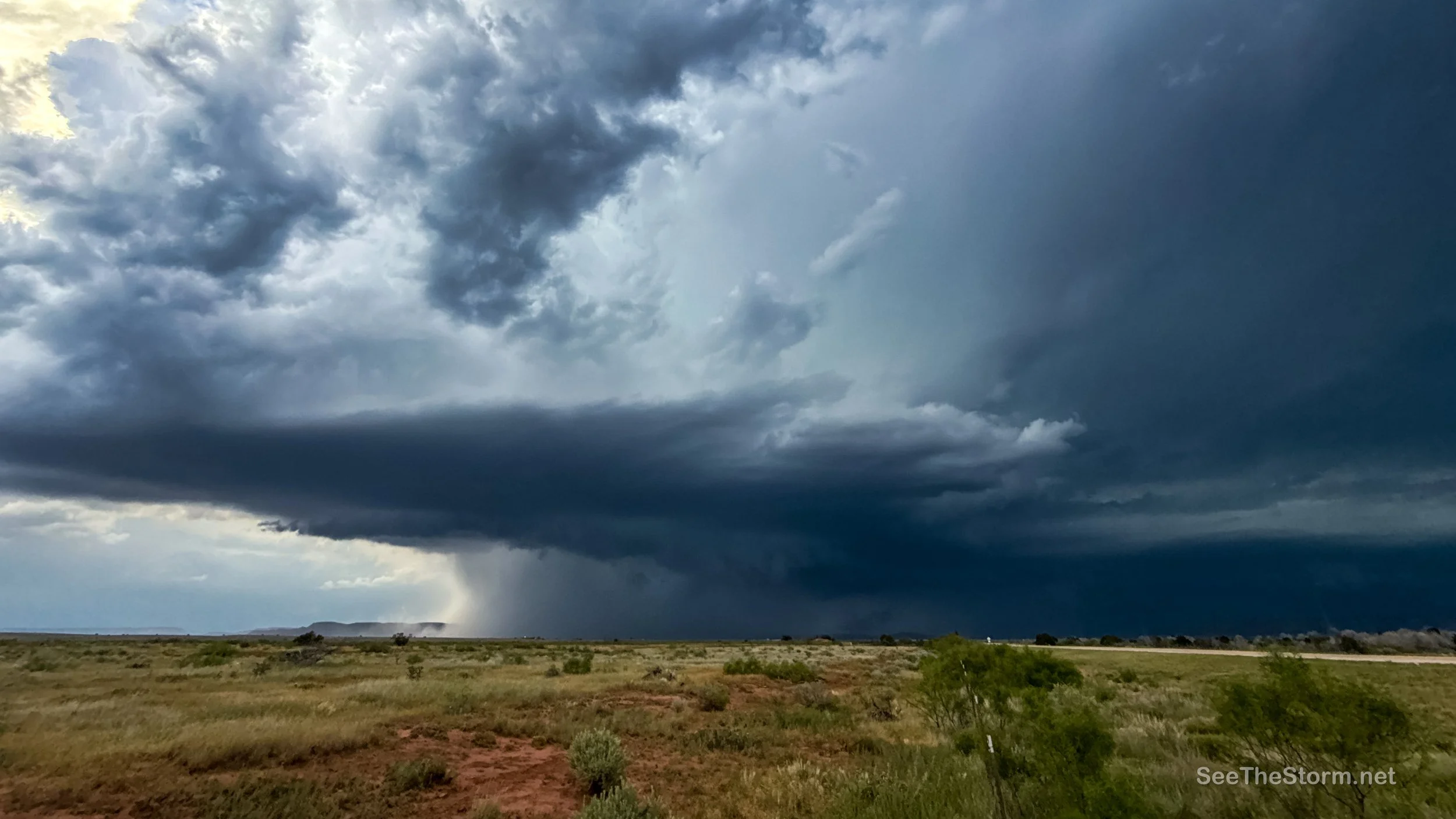
The more intriguing part of today’s setup lies with the outflow boundary left behind by this morning’s MCS. This boundary stretches from the MCS westward across the Texas South Plains into southeast New Mexico. I’ve highlighted the rough area of the OFB on RadarOmega visible satellite below.

Over the next few hours, it’s likely to drift southward before stalling out. By late afternoon, there’s a chance it could start creeping back northward as almost like a warm front, depending on how morning and early afternoon storms play out to its north. Pinpointing exactly where this boundary will end up is not easy—mesoscale features like this are tough to nail down—but it’s shaping up to be the focal point for some serious storms later today.
As temperatures climb into the mid 80Fs to low 90Fs west and south of the outflow, the atmosphere will become primed for action. Strong buoyancy (rise/lift), especially south of the boundary where heat and humidity peak, combined with southeasterly low-level winds and stronger westerlies aloft, will create a setup for discrete supercells. These storms could bring the full spectrum of severe weather: very large hail, damaging wind gusts, and even tornadoes. The highest supercell coverage is expected across far southeast New Mexico into the Texas South Plains, where the SPC has issued . There’s also a chance for a tornado hot spot somewhere along the outflow boundary, but its exact location uncertain.


Any storms forming north of the outflow boundary could still produce hail and wind, but less likely of a tornado risk.
Beyond Texas, another area of concern is taking shape into Kansas and Oklahoma. A warm front, fueled by northward-moving low-level moisture, will set up from southeast Colorado into southern Kansas, acting as a potential focal point for storm development.

Storms interacting with this boundary, along with new storms firing up along it, will likely organize into supercells early on. These could produce very large hail and tornadoes, especially in their initial discrete phase. As the evening progresses, these storms may merge into a larger complex, spreading across parts of Kansas and Oklahoma. At that point, damaging wind gusts will likely become the main threat.
Target area: Lubbock area, with consideration on potentially altering to the northern mode.
Tomorrow
There’s a large slight risk for severe weather across the board, but the largest and most robust hail risk will be in parts of Colorado to West Texas. We’ll likely be targeting that with an update in the morning.
